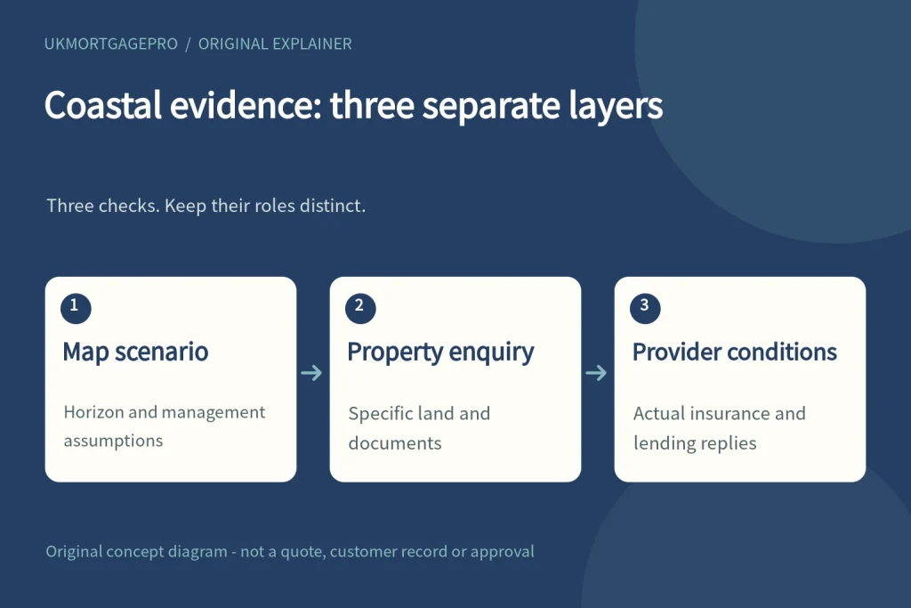
UKMortgagePro original relationship diagram: Map scenario / Property enquiry / Provider conditions. The three checks do not replace one another.
The short answer: do not substitute one map for another
A property can require a coastal erosion enquiry even when the information you have about flooding appears reassuring. The two enquiries are not interchangeable. The official England coastal erosion service describes estimated areas at risk under stated time periods and management scenarios; the long-term flood service describes area-level flood risk. Neither page is a mortgage offer or a property-specific insurance decision. For a non-resident buyer, the useful first step is to record which question each source answers and which questions still need a professional, insurer or lender response.
Read the time period and scenario before the colour
The GOV.UK coastal erosion service currently explains two horizons: the medium term to 2055 and the long term to 2105. It also explains two approaches to presenting risk: no future work to maintain or build coastal defences, and implementation of the current Shoreline Management Plans. These are features of the published mapping service, not promises about an individual house. A screenshot without its legend, selected period and scenario loses important context. Save the actual choices and date, and ask a suitably qualified professional to explain any implications for the specific property.
A shoreline policy is not the same as completed protection
The official page describes four broad management approaches: no active intervention, hold the line, managed realignment and advance the line. Their purposes differ. A reference to maintaining a shoreline should not be rewritten as confirmation that a particular defence has already been built, will be funded indefinitely or will protect every building in all circumstances. Keep current physical works, published management intentions and the map's scenario assumptions as separate entries. If a sales description combines them into a single reassurance, request the underlying document and a precise explanation rather than accepting the summary.
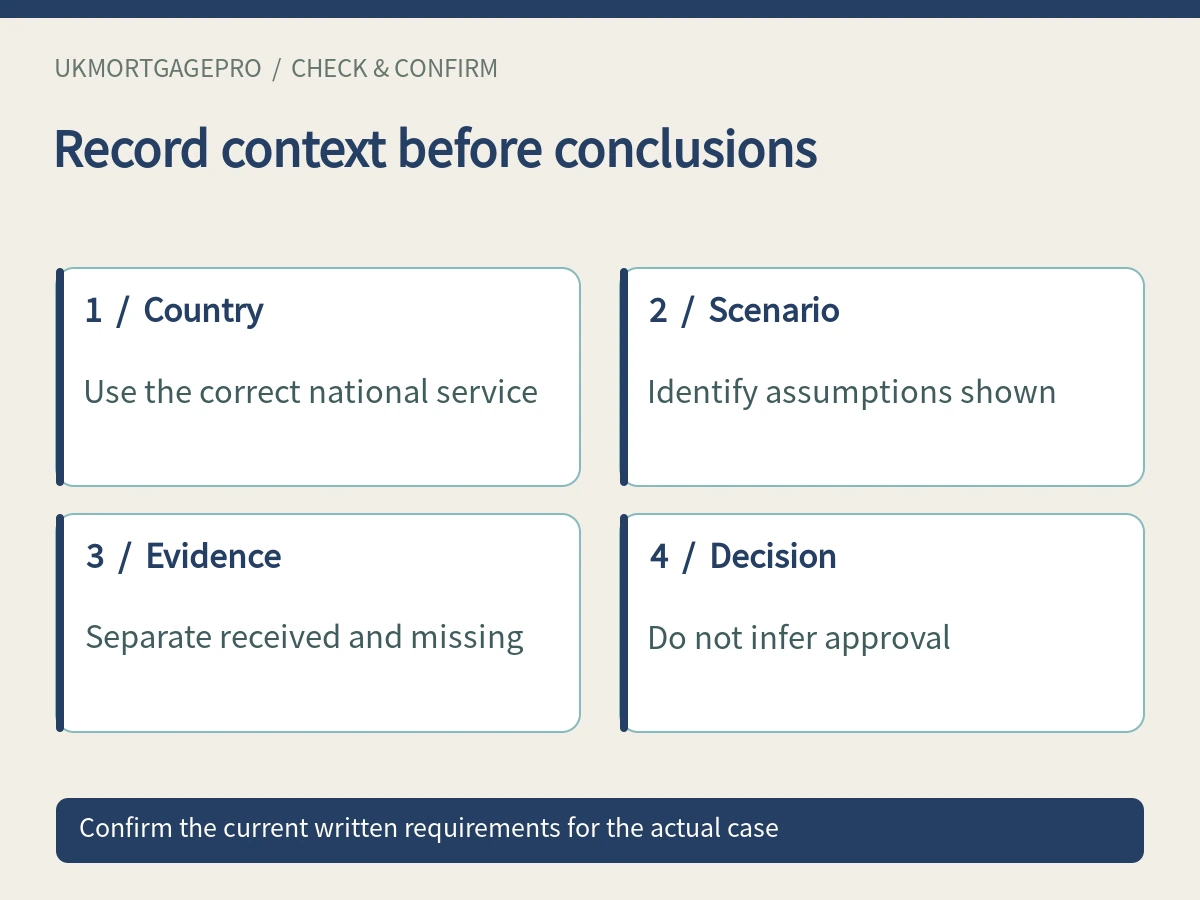
Use the correct country and geographical scope
This article concerns the England service. GOV.UK directs users to different information for Scotland, Wales and Northern Ireland. The property address, coastline segment and the land actually involved in the transaction should be established before any conclusions are drawn. Do not infer a plot boundary or ownership right from a regional hazard map. If the property includes several parcels or an access route, tell the conveyancer and any specialist assessor what is included in the purchase so that an enquiry is not unintentionally limited to the main building alone.
Build a practical evidence list for the property
Start with the actual map reference and relevant management documents, then ask what property-specific information is available. That may include existing professional reports, known erosion-related concerns disclosed by the seller and records of relevant works, where they exist. Label documents as received, requested or not known. Do not invent a survey history when the seller has not supplied one. Ask an appropriately experienced surveyor what an assessment would cover, which evidence it relies on and what limitations remain. A general search is a prompt for targeted enquiry, not a substitute for a commissioned assessment.
Keep insurance and mortgage enquiries separate
Provide consistent facts when discussing insurance and finance, but do not assume a favourable answer from one participant binds another. An insurance quotation, a lender's initial response and a surveyor's report serve different purposes. Ask the actual provider what remains conditional and what information is required for this property and intended use. This article does not state that a particular coastal address is acceptable or unacceptable to a lender, nor that a specific insurance arrangement will be available. It offers an evidence organisation method, not a prediction of the outcome.
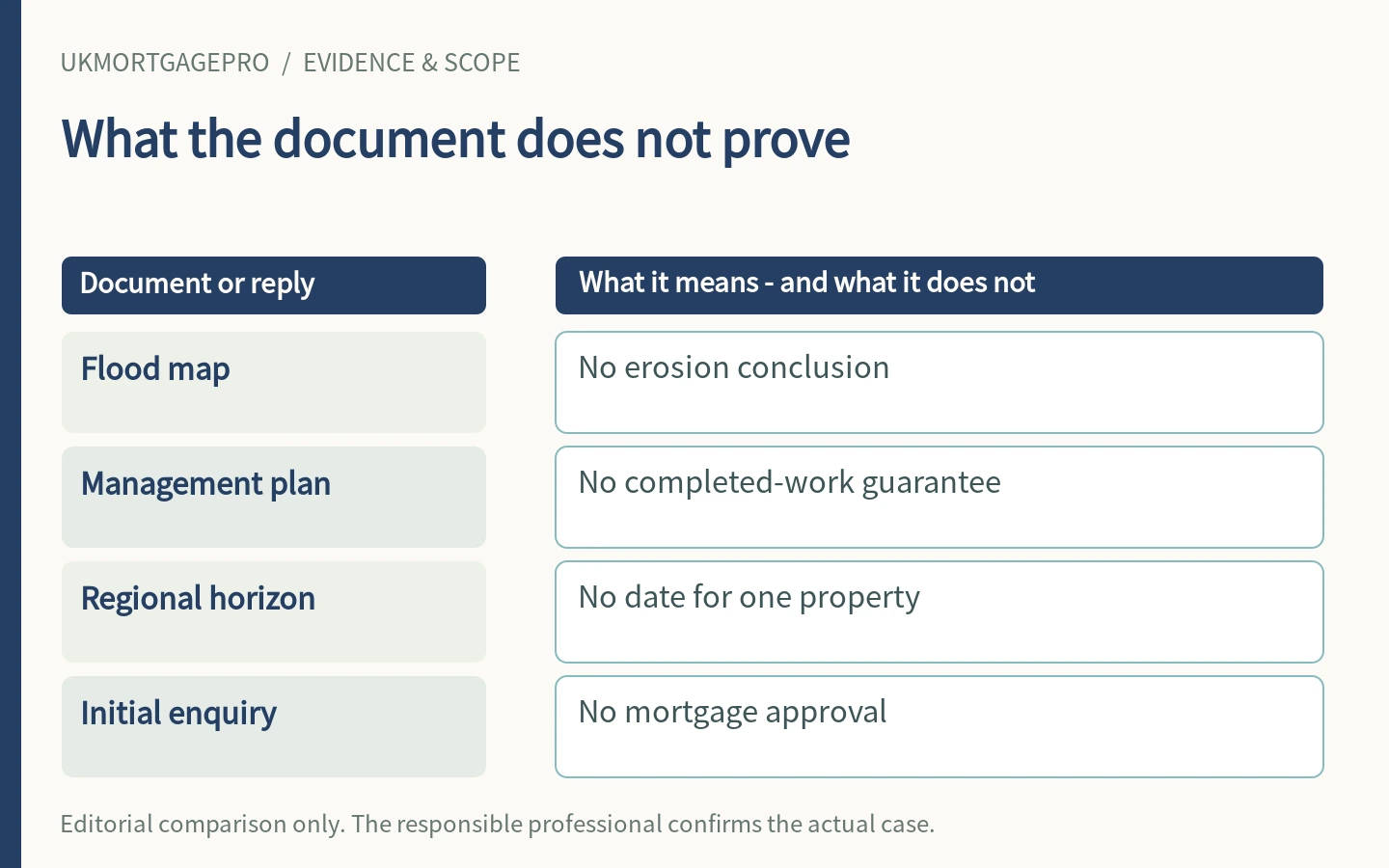
Avoid turning a long-term map into a completion forecast
The dates on a coastal erosion map are not a date on which a transaction will complete, a building will be affected or a loan will be approved. Equally, a mortgage term should not be matched mechanically to one coloured zone as though that establishes suitability. The practical financing question is which relevant uncertainties have been identified, who can evaluate them and what the actual parties require before proceeding. Obtain individual quotations for any necessary advice and clarify the work involved; there is no universal cost or turnaround promise in this guide.
Make the overseas handover clear
A useful initial note states the country and property location, purchase or refinancing purpose, intended occupation or letting use, current stage and titles or dates of available documents. It then lists the unresolved coastal erosion and flood enquiries separately. This helps an overseas applicant avoid sending several professionals conflicting summaries. UKMortgagePro's existing consultation route can be used to explain the mortgage enquiry and outstanding evidence. It is not a substitute for site assessment, legal interpretation or lender approval. Do not place identification documents, bank records or private transaction papers in a public message. If a response refers to a different address, map edition or intended use, flag the mismatch before relying on it. A shared document list is useful only when the participants are discussing the same facts.
Practical checklist
- Record England mapping service, observation date, chosen horizon and management scenario.
- Separate existing defences, management intentions and property-specific evidence.
- Ask the conveyancer and appropriate assessor which land and access routes need consideration.
- Keep insurer and lender replies in their own columns with outstanding conditions.
Questions to clarify
Does a low flood indication rule out erosion?
No. It addresses a different question, and the England flood service also states that it does not describe the probability of flooding for an individual property.
Does hold the line guarantee protection of my house?
The term describes a management approach in the official service. It should not be treated as an individual property guarantee or proof that all intended works are complete.
Will every lender take the same view?
This guide has not verified product-level criteria. The relevant lender must consider the actual application and property evidence; an enquiry is not approval.
Sources and scope
- GOV.UK: Check coastal erosion risk for an area in England — checked 2026-10-11; page publication/update date: not stated or not established
- GOV.UK / Environment Agency: Check the long term flood risk for an area in England — checked 2026-10-11; page publication/update date: not stated or not established
Public information and document-organisation guidance only; not personal mortgage, legal, tax, valuation or investment advice, and not lender approval or endorsement. Confirm current case requirements with the responsible professionals.
Related information and consultation
Non-resident UK mortgage preparation · Remortgage information · News and practical guides · Arrange a consultation. Enquiry acknowledgement is not mortgage approval.